Welcome
I am Menaka Revel a postdoctoral researcher in the Department of Civil and Environmental Engineering, Faculty of Engineering, Michigan State University (MSU) working with Dr. Yadu Pokhrel.
Please visit the Multi-scale FEW Systems Modeling Lab at MSU here.
I specialized the intersection of data assimilation, remote sensing, and hydrological modeling. By incorporating satellite measurements like satellite altimetry and surface water extent data into routing models like CaMa-Flood, and Raven, I aim to improve the realism and forecasting ability of large-scale hydrological models.
Before joining MSU, I worked as a postdoctoral fellow in the Department of Civil and Environmental Engineering, Faculty of Engineering, University of Waterloo, where I contributed to the Hydrology Group.
Previously, I served as a Project Researcher in the Global Hydrodynamics Lab in Institute of Industrial Science, The University of Tokyo from Oct 2019 to Aug 2023. There, I collaborated on projects that explored freshwater dynamics on a global scale using modeling, remote sensing, and model-data integration.
Please visit Global Hydrodynamics Lab at the University of Tokyo here.
My dedication to open science and data accessibility has been a recurring theme in my work. Through user-centered, web-based platforms, I actively create tools and procedures that facilitate the exchange of data, model configurations, and research outcomes. The goal of my work is to close the gap between large end-user groups and sophisticated hydrological systems. Please visit my GitHub page for the resources for hydrological modellers.
Research Interests
My primary research interests are developing earth system modeling by integrating remote sensing data into models. Previously, I was working on modelling Canadian lake-dominated watersheds and calibrating the models like Raven using remote sensing data such as Landsat, Sentinel, and SWOT. I also have been working on data assimilation into hydrodynamic modeling using satellite altimetry data. I am also involved in developing CaMa-Flood hydrodynamic model for a better representation of global fresh water.
My research activity is summarized in:
Source codes
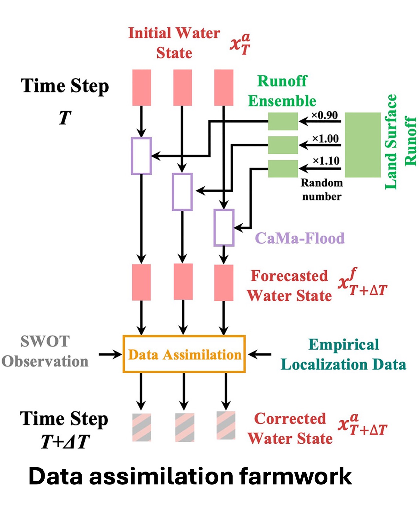
MulCal: Local calibration framework for Raven hydrological modelHydroDA: Data assimilation framework
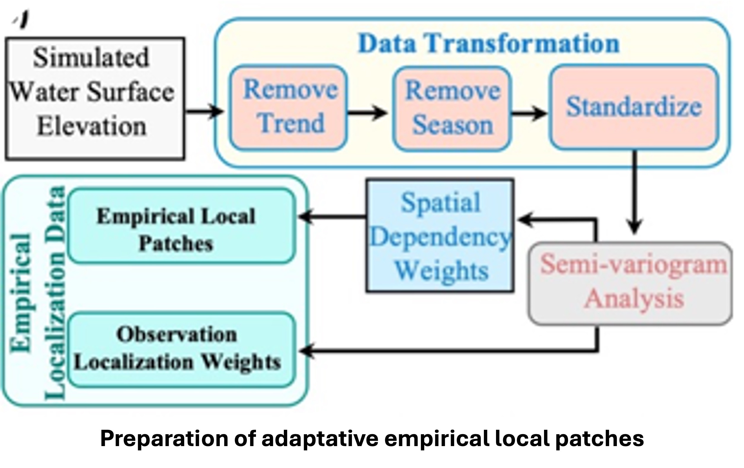
Emprical Local Patches: Code for preparing empirical local patches
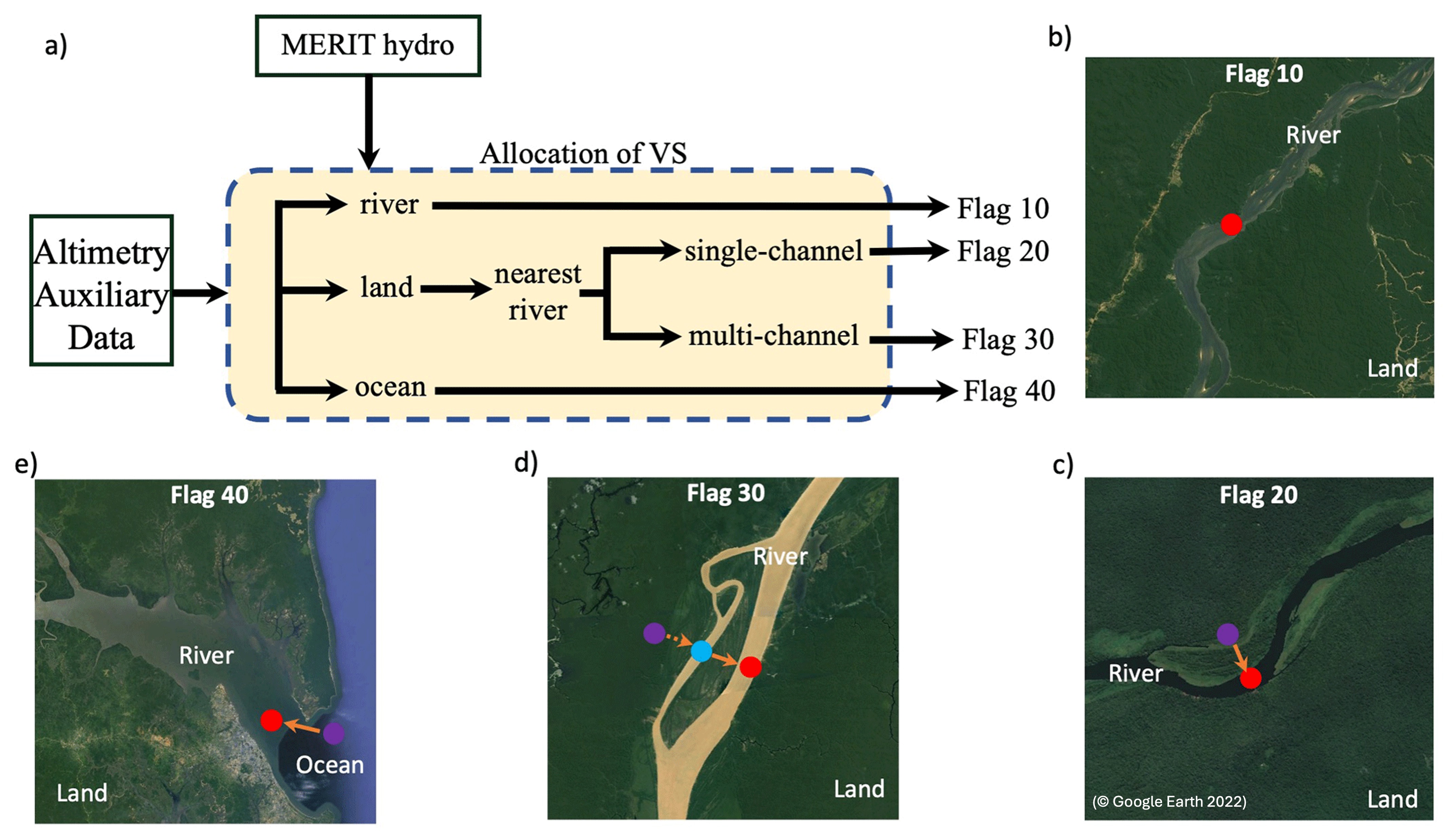
AltiMaP: Code for allocating satellite altimetry to CaMa-Flood
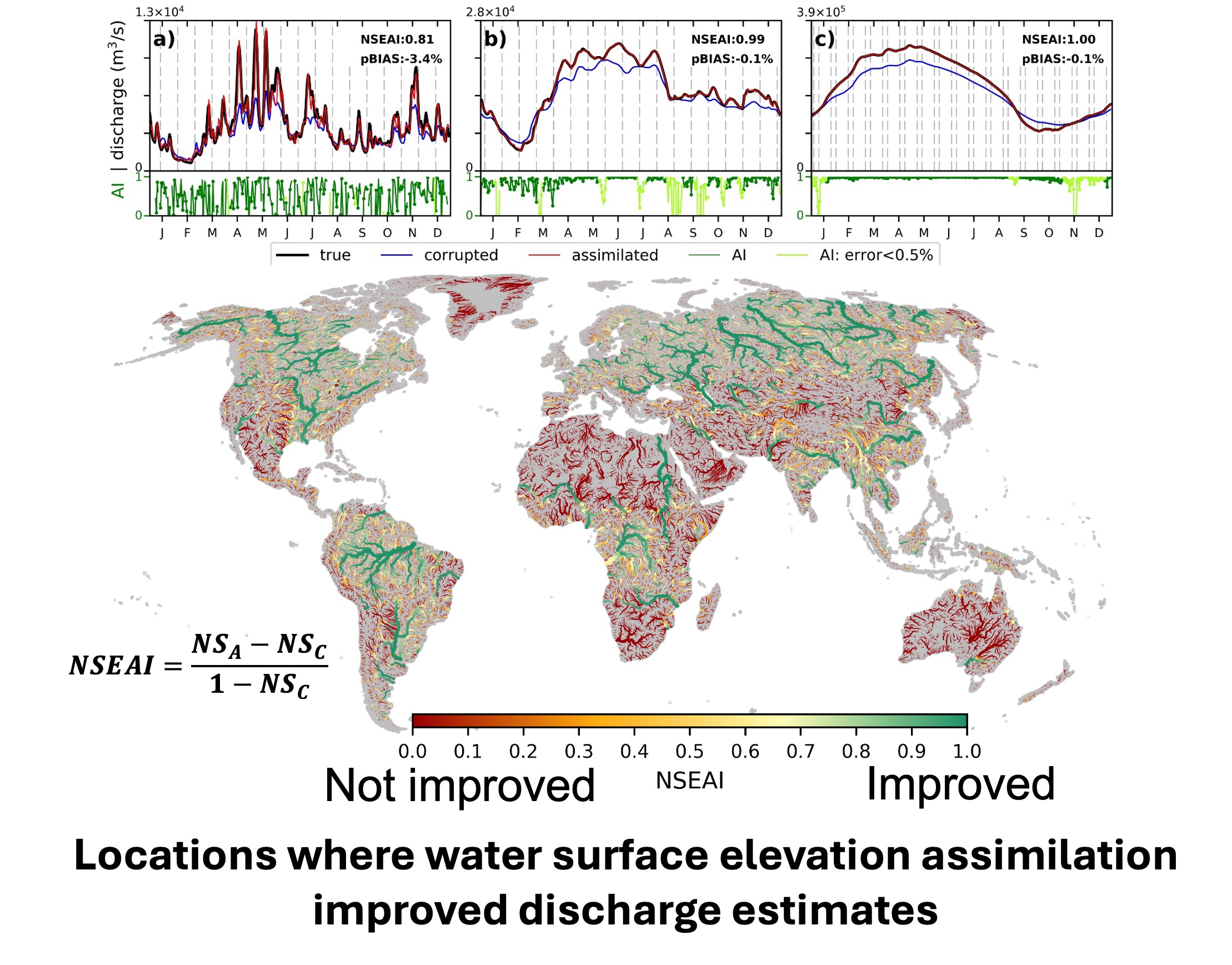
CaMa-DA Package: CaMa-Flood satellite data assimilation package
News (Twitter)
If the News cannot be seen here, please kindly visit my X profile: @menakarevel.
X by Menaka RevelHighlights
25 June, 2026 -
WHiLD-HM: A high resolution daily hydrometeorological dataset for the western United States
20 May, 2026 -
Application of HydroDA for real-time data assimilation
18 Mar, 2026 -
1 Nov, 2025 -
Moderate-resolution hydrodynamic models can still capture the essence of global river dynamics
28 Mar, 2025 -
Climate change and ENSO enhances seasonal flood
13 Mar, 2025 -
CaMa-Flood benchmark framework
11 Dec, 2024 -
Menaka presented in AGU@Washington D.C.
11 Dec, 2024 -
Menaka’s poster at AGU, Washington D.C.
29 May, 2024 -
Menaka presented in CGU@Ottawa