Blog
Unlocking Rivers: How Satellite Data is Revolutionizing Global Water Management
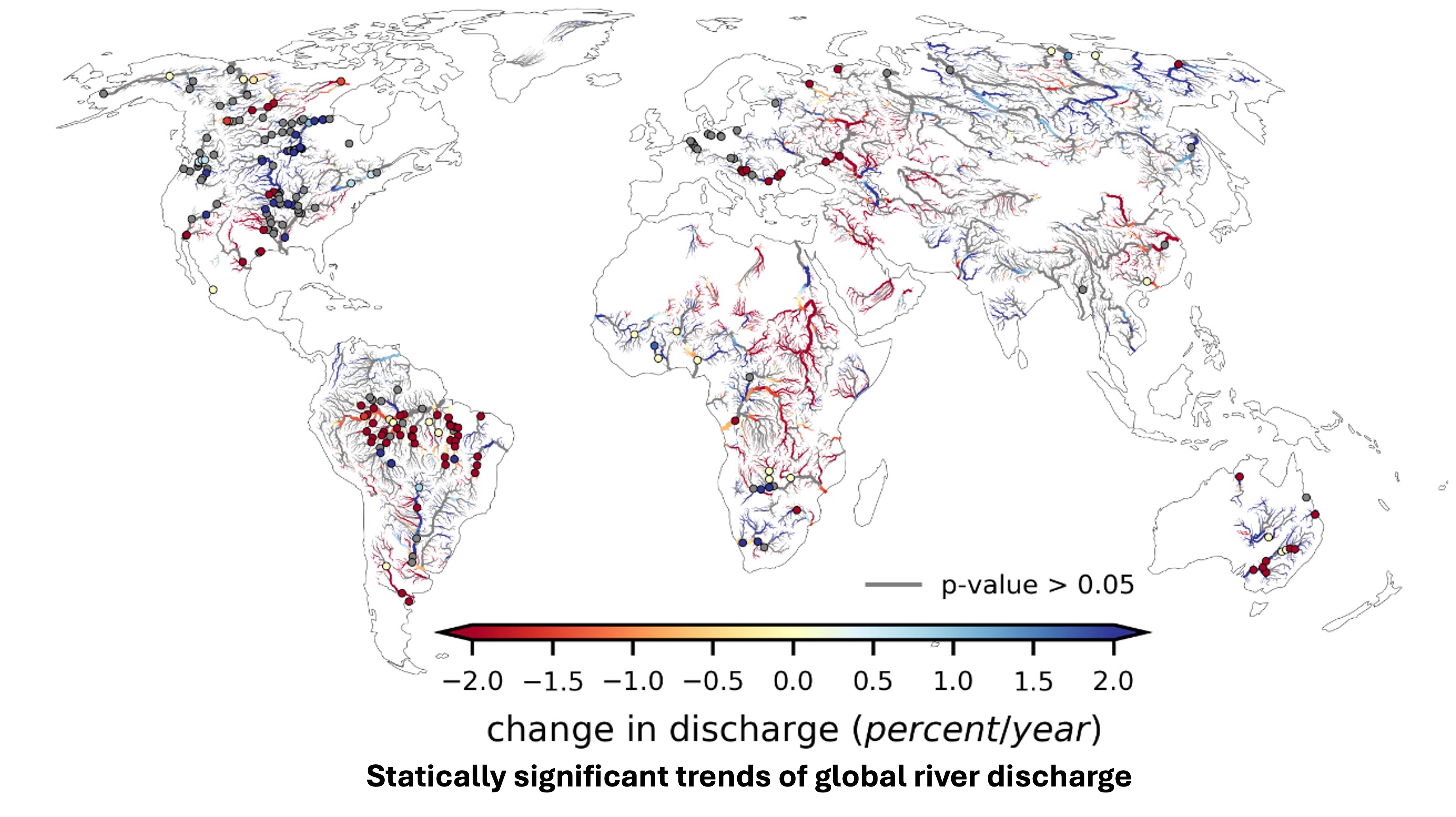
Rivers are the arteries of our planet, carrying life-sustaining water across continents and supporting billions of people. Yet monitoring these vital waterways remains one of the greatest challenges in hydrology. How do we measure river discharge across vast, remote basins where traditional gauging stations are sparse or non-existent? The answer lies in a cutting-edge approach called hydrological data assimilation—a powerful method that combines satellite observations with numerical models to paint a comprehensive picture of global water resources.
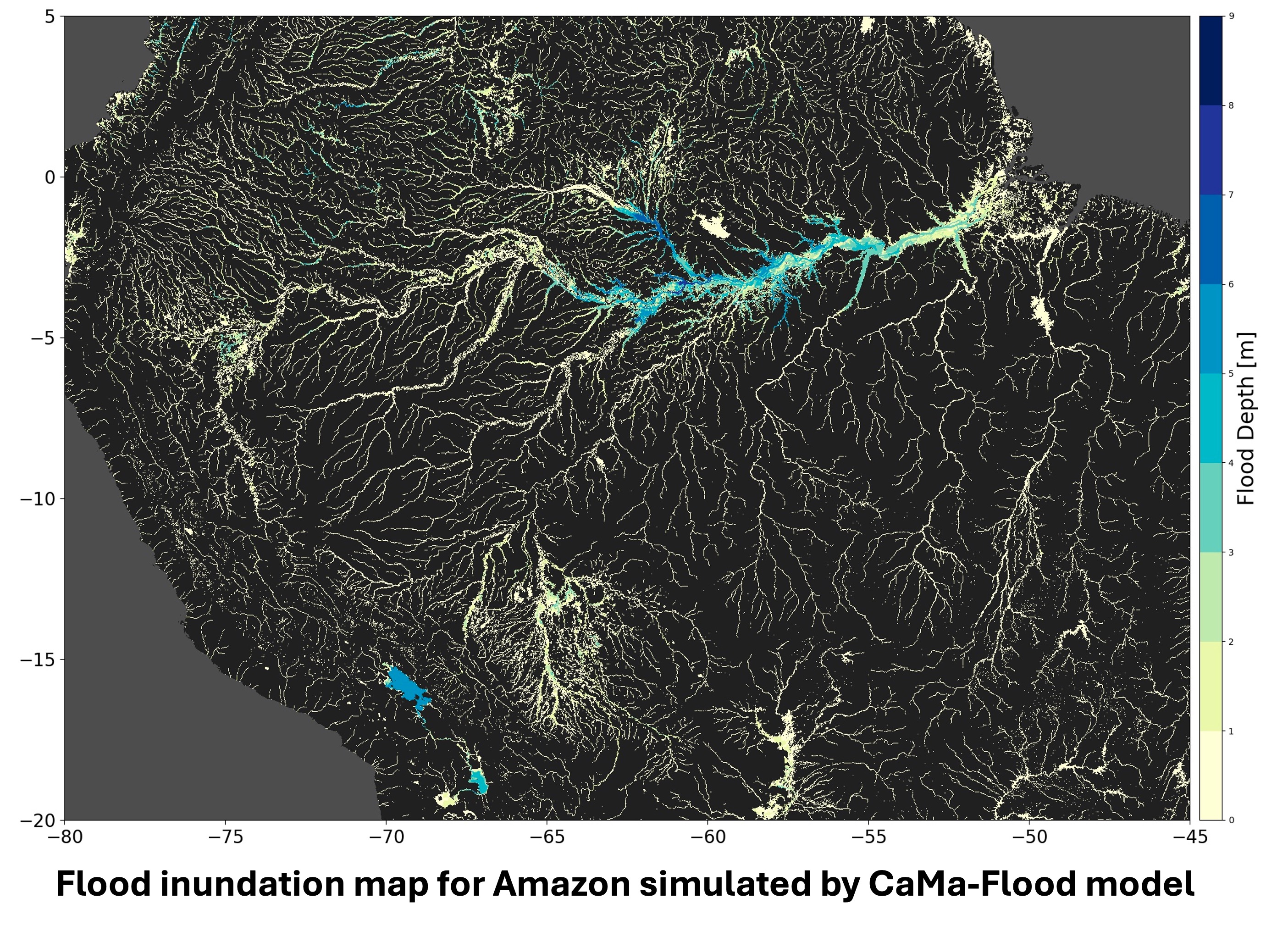
Advances in Global Flood Hazard Mapping: From Regional Models to High-Resolution Global Coverage
Over the past ten years or so, flood hazard modeling has taken some big steps forward. What once relied heavily on region-specific tools and disparate methodologies is now evolving into a more coherent, globally consistent effort. A handful of landmark international studies—four, in particular, spanning from 2015 to 2024—along with Canada’s own national push to standardize flood hazard delineation, highlight a shift: from patchy, regional maps to detailed, climate-aware global coverage that’s more than just technically sound—it’s designed for real-world application.
Remote Sensing of Terrestrial Waters
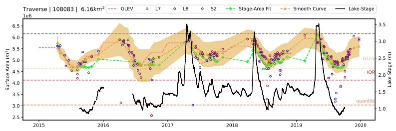
The availability of an in-situ global monitoring system is often hampered by the unavailability of accurate, complete, and freely accessible data. In the age of satellite big data, a wealth of information gathered from space is accessible for monitoring terrestrial waters. Satellite data serves as a crucial supplement to the limited in-situ gauging networks, particularly in developing countries where ground-level monitoring may be insufficient. We observe several types of satellite data available, including satellite altimetry, water surface extent, soil moisture, total water storage, and more.